Monday, July 16, 2012

Longs Peak

Despite the title of this post, I'll start out with a picture of Mt Rainier I took last week during fieldwork in Washington.

We have some impressive mountains here in Colorado, the subject of the remainder of this post being one of them, but our peaks don't hold a candle to the Cascade volcanoes. They rise, seemingly out of nowhere (well, out of a magma plume, but I don't want to get too terribly dorky here) and in Rainier's case thrust 14000 feet from sea level, utterly dwarfing the mountains around them.


And at any point, they could blow their tops, as Mt St Helens did three years before I was born. 

Back to Colorado.

After I got back from Washington, I decided the time had come to run Longs. I have lived in Boulder for years now, seeing this mountain dominating the skyline every time I drove up 36 from Denver, and yet for no apparent reason I had never climbed it. So, Saturday morning, after taking the chance to sleep in, I decided to give it a go. 

I reached the trailhead late enough that I had to park a good half-mile down the road. I expected as much, arriving at 10AM when most hikers leave between 2 and 3 in the morning. Remembering to put on sunscreen, I strapped on my UD Katoa waistpack, grabbed an extra water bottle in a UD Quickdraw, and headed up the shallow trail, 5100' of climbing and 7 1/2 miles of running and scrambling ahead of me. 

As sometimes is the case, I felt sluggish the first two or three miles. When I got up out of the forest, and to treeline, I started to feel a little more energetic, and picked up the pace a bit. Past the Chasm Lake junction, I felt even better and proceeded up to the Boulder field in just over half an hour. The boulder field, I think, was the most fun I had on the trip. Rather than follow the track, I regressed back to my days in Minnesota, rock-hopping along the shores of Lake Superior, and took a direct route to the keyhole, crossing the field and making it to the keyhole in under 15 minutes. 

The Keyhole
Beyond this, I had been a little nervous about the route. I knew it grew significantly more exposed and more of a scramble than a run. I surprised myself, though, by finding this section unimposing, and actually quite fun. I started to run into more people descending the route, here, and was often forced to take a higher or lower route across the Narrows, and a steeper route up the Trough, scrambling in truth now where I had danced across the Narrows.

Around here people started to notice me (the bright green shirt might have helped) and began to a) get out of my way and b) ask me when I had started and how long I expected to take to get to the summit. When I told them 10AM and 2:30, respectively, most decided I was crazy. I neglected to mention Tony's recent 1:42 up this route.

I did not, unfortunately, make it to the summit in the 2:30 I had hoped. I realized this wouldn't happen while scrambling the Home Stretch, and let it go. I finally crested the top at 12:36, exactly 2:36 from the car.
By this point, though, some storm clouds were forming, and after a few quick pics, I took off down the same route I went up.
The weather that chased me all the way down and caught me in the parking lot.

The summit. I was amazed how huge it was, though I had known and expected it.

Looking back down the Homestretch, some climbers are visible in the distance.

I took my time descending, and by this point my quads were telling me it would be a long run back to the car. By the boulder field, I was less running and more picking my way, even taking the path for a brief period. Nonetheless, the last several miles were quick, as I (barely) outpaced the rain to my car.

Total time running was 4:34. I took some time to look around on the way down, making my car-to-car time (including the extra half mile each way) was 5 hours flat.

All in all, a very fun day on the mountain. I learned that I am, to my surprise, quite comfortable on the semi-scrambling bits. I am also, apparently, quite surprisingly quick on these sections, choosing to bolt forward in short bursts, taking short breaks when needed, rather than move at a steady slog. In the words of one other climber, who I saw on my way up, and passed again on my way down the trough, I "crushed it."

And I caught the bug: looking forward to another adventure on Meeker this weekend.

Sunday, July 1, 2012

Leadville Marathon 2012: Race Report.

Well,  the marathon is over for another year. I made one of my three goals, which is clearly that of beating my time from last year. I admit my first goal was decidedly a reach for me, and very likely my second as well. Simply put: Leadville is a tough race, with 6300 feet of climbing and descending in a 26 mile course.

So, am I disappointed in the race? I must admit to a little bit, but very little for all that. Rather than do a blow-by-blow account of the race, I'll break from tradition and just give a general breakdown of what I did right and wrong, and my general thoughts and lessons from this race.

First of all: what I did wrong.

Or maybe rather than wrong I should say I was careless for most of these.

This started long before the race. Wednesday, while I was supposed to be tapering and taking it easy, I ran 11 miles, doubling for the day, with some up-tempo miles in there. That is never a great idea right before a race, and I think it led to some lingering fatigue on the start line. But I won't beat myself up about that, since I run because I love it, and the run on Wednesday afternoon was very enjoyable.

The second way I was careless was in my packing. For the most part I was ready days ahead of time for the race itself. What I was not ready for was breakfast the day of the race. Traditionally for me this is a double-dose of Quaker Instant Oatmeal (Maple and Brown Sugar flavor). Unfortunately, I neglected to pack any sort of utensils. My backup was bread with peanut butter and jelly, but I opened my bread to find it moldy. I ended up eating a granola bar and a cliff bar for breakfast. I'm not sure that was enough for somebody like me.

The only other thing I can say that I did wrong was not push hard enough up Mosquito Pass. But this is also something I did right.

On the starting line Saturday morning, I looked up at the pass and wondered just why I was doing this again. This race had wrecked me last year, physically and emotionally. I knew what was in front of me, but I signed up again.

This time, though, I knew what I was getting into. I knew the course, and I knew my own abilities better than last year. I decided on a plan: I didn't want to feel anything until after I got down from Mosquito Pass. I remembered last year that I had been strong until the bottom of the pass, and had ended up walking flats and even some downhills afterwards.

So I took it easier than I thought I needed to. I hit the first aid station 2 minutes slower than last year, stride for stride with another Boulder runner I've encountered now and then on the trails. Hitting the bottom of the pass, 10 miles into the race with a 3 mile, 2000 foot climb ahead of me, I felt fresh. I alternated running and power hiking up the pass, whichever felt more efficient for the grade, running my own race and not worrying much about the other marathoners. I knew my race would come in the last ten miles.

And my plan worked. I hit the bottom of the pass in good shape, compared to last year. I was running the road up to Ball Mountain, where I had walked last year. I even ran most of the way around Ball Mountain, which I mostly walked the previous year.

I also took better care of my nutrition and hydration this year. I took a gel every 45 minutes. Every aid station, I topped off my (mostly empty) water bottle and downed a cup of Gu-Bru. And at the top of Mosquito Pass I took to S-Caps, just to be safe.

I ran my own race, had my nutrition dialed in, and passed 5 or 6 runners in the last 10 miles while being passed by 2. A much smarter race than last year, yet I shaved only 4 minutes off my time.

Which makes me consider again just how hard a race this is. My synopsis: I took too far on the "taking it easy." I probably could have shaved a good 2-3 minutes off my first 4 miles, and 3-5 minutes off my time up Mosquito Pass and been ok for the last 10 miles.

So, am I pleased  with my race? Very much so. Am I also a little annoyed and disappointed? Of course. But if everything goes perfectly, you don't learn anything. In that spirit:

Things done right:
1) Had a race plan, and stuck to it (in spite of occasional doubt).
2) Nutrition/hydration.
3) I took the chance to enjoy the race, the scenery, and chat with some other runners.

Things learned:
1) TAPER!!!
2) It doesn't matter if you remember your Oatmeal if you forget your spoon.
3) I'm in better shape than I've ever been, and can therefore push a little harder.

(On a side note, I was very happy to run into a number of people I knew at this race. Several people mentioned knowing who I was from the Wednesday runs at the BRC. There was also a sizable contingent from Boldrunning there, including one very vocal spectator. It made the finish line that much more fun.)

Friday, June 29, 2012

And I'm Off

Sayonara.

I'm off to Leadville for the night before the race tomorrow!

Primary Goal: 4:15
Secondary Goal: 4:30
Tertiary Goal: My time from last year: 4:46.

Given my vastly superior fitness this year, I should be able to manage at least #3, probably #2 as well.

Monday, June 25, 2012

James Peak Dreams

With Boulder smashing several heat records in the past few days, and a large portion of the state on fire, it seemed like a good weekend to get up high. This being Colorado, everybody had the same idea, and the high country was packed with people of all ages, and abilities, all weekend. 


After an excellent day on Saturday (finally) experiencing the Georgetown Loop narrow gauge railroad (picture above), I decided to head up to the James Peak Wilderness Area on Sunday. In July, I will have lived in Boulder for a full 7 years, and yet somehow I have never been up to the James Peak area. I can only claim ignorance on my part, and possibly I was deterred by the 8 mile dirt road to the trailhead. I had naturally assumed this might be a road similar to the road to the Fourth of July trailhead, but I could average 45 on this road without worrying about my car. 

Once there, I had no idea what trail to take. I only knew I did not want to go too crazy with the marathon coming up in under a week now. Luckily I ran into a couple friendly former trail runners (I did not ask about the "former" designation), who directed me up Rogers Pass trail to Heart Lake. 

The runners had warned me that this was a steep trail, but I found it to be a very relaxed grade, rising only 2000 feet or so in the 4 miles to the lake. The run itself is gorgeous, crossing South Boulder Creek and its tributaries numerous times as it winds its way up towards Rogers Lake and the (eventual) path. At no point did the grade feel steep to the point that it would be more efficient to walk. 

About a mile (rough estimate: I didn't wear a watch) from Heart Lake, the trail takes a marked turn upwards, alongside a many-channeled cascade, which at the time I ran it was full of wildflowers. 

As you can see, it was actually cloudy. I was not complaining.
Half a mile later, it came alongside Rogers (Pass?) Lake, through a boggy patch, reminiscent of Minnesota, and I noticed something surprising: several miles in, and almost 2000 feet up, my legs felt fresh. There was no feeling of effort the entire way up, and I crushed the last half mile or so up to Heart Lake (startling a couple unsuspecting hikers along the way).

From Heart Lake, the trail continues up the side of a mountain up to the Divide. 

The clouds don't look bad, but they were rumbling.

I opted out of running to the ridge this particular day. Between the marathon next Saturday, and the rumbling clouds, I decided it wasn't a good idea. Either on its own might not have deterred me, but the last thing I wanted to do was race down the side of a mountain in a thunderstorm and risk messing up my ankle this week. So instead, I stopped, took a few pictures of the area, and the peaks I want to tag next time, and turned around for a leisurely run back to the car. 

The view around Heart Lake.

Unidentified "to be tagged" peak #1

Unidentified "to be tagged" peak #2

Unidentified "to be tagged" peak #3 and 4
 I actually felt a few drops of rain on my way down, good news for a state that seems to be on fire.

Round trip, this run took me about 2 hours, but as I said, I was not pushing it. Now that I've seen James Peak Wilderness, I am astounded that I have not been up there before. Between Leadville and Pikes, I fully plan to grab a map, take off early some Sunday morning, and tag James Peak and several of these other peaks. They are just begging for it.

Meanwhile, the taper for Leadville is in full force. I think I might be able to throw down a bit on Saturday.

Wednesday, June 20, 2012

June 20, 2012: An interesting week so far.

It has indeed been an interesting week so far, both in running and in the rest of my life, and it's only just Wednesday.

Let's begin at the beginning. As was my plan, I ran High Lonesome again this week, to acclimatize further for my race in Leadville in a week and a half. This time, though, I got the pleasure of running with another Boulder Trail Runner. He had emailed the BTR group earlier in the week, and on a whim I responded saying I was going to run it on Sunday if he wanted to come. So I picked him up and off we went.

It turns out he was a little tired from running 9000' so far that week. I was feeling pretty decent, so I ended up waiting more than usual. But that was fine with me, since I was not interested in pushing too hard in any case. Once we got up to the divide, though, there was no option but to push hard. The wind was blowing at a good 20mph constantly with much stronger gusts, and it was an effort just to keep going and not fall over. King Lake trail was still a bit of a mess, but somebody had been up with an axe and taken care of some of the trees that had been across the trail last time. And even with the slow pace, the wind, and the trees, we hit the bridge at 3:12, a full 12 minutes faster than last week.

With that run behind me, I planned on a short run Monday, followed by a run up Flagstaff on Tuesday morning. The high for both days was in the upper 90s, so I hit the trail early on Monday and put in 4 miles. At the end, though, I was dismayed to look down at my shoes and find that I had busted through the sidewalls. I had only put 220 miles on them, but off to the BRC I went. There, of course, I ran into a couple friends who were heading for Flagstaff from the store.

Naturally, I opted to go with them on Monday rather than by myself on Tuesday. These two particular runners are fast (one was an Olympic Marathon alternate four years ago) so it ended up being a bit of a tempo run for me. Nonetheless, I set the pace on the way up, and kept up the whole run, for a good 10 mile, 80+ min, 1500'+ run.

With that, I opted to take Tuesday off, knowing that I would get a good run in on Wednesday. And sure enough, when I showed up today, there were Jason Hartmann and Tyler McCandless, along with the regular crowd. We had a group of 25 or so go out at 6:45, and negative split the whole way.

To my astonishment, not only did I keep up the whole distance, but I didn't even feel like I was pushing hard. For comparison, I went at a 6:50 pace last week and felt like I was pushing it. I think I've arrived at just the right time.

Now, for the not so fun bit. My home town of Duluth, MN, home of Grandma's Marathon was hit by severe flooding today. They got upwards of 9 inches of rain in a 24 hour period. Flash floods took out part of a hotel, caused streets to drop by 4 feet plus, and causes sinkholes to open up. My parents' house was spared any damage, thankfully. The zoo was not so lucky, however. Two seals got out and ended up flopping and swimming down a nearby (busy) street. One of the polar bears made a (short) dash for freedom. And sadly, 11 of their animals drowned.

More info is here. I am considering going back to volunteer and help clean up. Even more info here.

Tuesday, June 12, 2012

High Lonesome Loop

While out on a run this past week, as I often do, I started thinking about this blog and, specifically, how I have neglected it lately. Even more so, I have neglected to focus on the primary topic: running. Thinking a little further, I realized that I had neglected to mention my goal race for the current training period. 

Without further ado: in two and a half weeks I will be a repeat offender at the Leadville Marathon. I ran this last year with very satisfactory results, finding it to be a well run race with excellent spectatorship (for a trail race). It may not compare to the trail races in Europe, but then there are few to no races here that do. This year, I am going into the race with several hundred more miles of training under my legs, a higher weekly mileage, and after this weekend, a good proxy run. 

With that in mind, a week ago, I opted to head up to Indian Peaks for the classic: the High Lonesome loop to get some time in at altitude. This time last year, the trails were still choked with snow low on the King Lake trail. This year I made it up to Jasper Lake before the snowfields hit. 

I had known from the start that I was not going to come near to the FKT of Koski (2:28) but I thought the old FKT of 3:11 would be well within my reach. My legs were feeling good, after a week off from running. Those ideas were quickly thrown out, however, with the first patch of downed trees. I realized early on that there would be a little route-scouting involved in this run. 

As I said, I got up to Jasper before I encountered the first snow patches. Quickly, though, I found my way increasingly blocked by extensive snowfields, as well as the trees that would be the main obstacle of the day. It took me less than an hour to get to Jasper, but the stretch from Jasper up to Devils Thumb Lake took a good half hour or more, at times wandering in the general direction I thought the trail might go. Few enough people had been there before me (and apparently none that weekend) that there were no footprints to follow. 

At Devils Thumb Lake, the trees cleared out, and most of the snow was gone. This had led to a meadow full of little yellow and white flowers. Somehow, the picture just doesn't do the scene justice. 


This was also the first dose of wildlife, other than deer, I've gotten on my runs so far this year. The marmots were out and about, staking out territory and making their presence known. I'm pretty sure this is the same one that ate through some of my food the last time I was backpacking up here.

The last press up to the pass up to the pass was, as ever, a bit of a slog. Thankfully, though, this east-facing slope was free and clear of snow. Free, that is, save for the inevitable snowfield at the top, which somehow seems steeper and more intimidating when you're out there on your own.

You can see in the picture where people had been up and over before me, though certainly I was the first one to cross it today. Again, the picture doesn't do the scene justice, but believe me when I say it was steep. I made it to the pass at 1:45 on the dot

Once on to the High Lonesome Trail (a part of the Continental Divide Trail) the going was open and easy. Easy at 12000 feet means something entirely different than easy at sea level, but still, for the location, it was easy. I made the 2.5 mile or so crossing in 20 minutes, hitting the King Lake Trail at 2:05. Then I got to see what was in front of me.
Hard to see, but there's a trail between those two snow fields. 
Those snowfields were deceptive. For the most part, the snow crust was thick enough to easily bear my weight (thank you big feet!). Every fourth or fifth step, though, the crust would give way, plunging you up to your knee in snow, and abrading your shin in the process. By the time I made it through the first field, my shins were scratched and a bit bloody, and I was dreading the next. 

Footsteps
I made it through well enough, and the next several miles were punctuated by the ubiquitous downed trees, and their corresponding delays. There were points where I would lose the trail in the trees, and end up down-slope of the deadfall scouting to find just where the trail had gone. 

Eventually, of course, I made it to the section where the trail maintenance crew had already been hard at work, and the winter's deadfall was cut away from the trail. Still, the damage had been done, and my final time back at the bridge was 3:25. Decently respectable, given the conditions. My plan as of now is to head back up on Sunday and see what sort of time I can post.

(As a follow up, I ran a 21 mile loop, from my apartment, of Sanitas, Flagstaff, and Green Mountain here in Boulder in 3:45 this past weekend. And not once did my legs even feel mediocre. If I can run like that on tired legs, I think I'm ready for Leadville.)

Thursday, June 7, 2012

Grand Canyon Pics


As I mentioned in my last post, almost two weeks ago now my girlfriend and I headed out to the Grand Canyon for a much needed vacation. On telling anybody this, the first question I inevitably got was: "Are you going to do a Rim to Rim to Rim Run?"

My answer, for this trip, was no. Since I was going with my girlfriend, and she is not a runner, I thought it would be poor form to take a full day to run across the Canyon and back, and then be wrecked for the rest of the trip. Instead I treated this trips as two things: first, a much needed break in running mileage and second, a scouting trip.

The view from our 2nd and 3rd night campsite
That said, I did run a few miles, and hike a significant amount. We hit the North Rim, which is much more pleasant (in my humble opinion) than the South Rim. The Kaibab Plateau drops off precipitously into the canyon at its edge, but until you get to that edge, you are in a wide open ponderosa pine forest, with little indication that as little as a few yards away the land drops thousands of feet into one of the most spectacularly scenic areas in the country.

We were fortunate enough the second and third night to get one of the prime campsites on the very edge of the canyon. As many of the people walking by said, sleepwalking, or even wandering around at night without a headlamp, could be fatal.

As I mentioned, I did not run much at all while we were there. I took a couple early morning runs along the transept trail, leading from our campsite to the Grand Canyon Lodge, but aside from that G and I went hiking, and took a mule ride. Initially I was a bit frustrated with not getting a chance to run as much as I would have liked, but as it turns out, I think the break, and relatively mild hiking we did throughout the trip, helped my legs recover significantly from the miles I have been putting in this year.

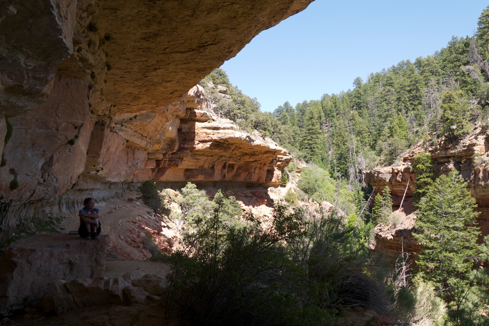
We took several hikes, along the Cape Final trail (where the prickly pears were in bloom), as well as along the Wildforss Trail and a few other smaller trails. We were lucky enough to get the Cliff Springs trail to ourselves. This particular trail leads from one of the most popular areas on the North Rim, Cape Royal, to a secluded smaller offshoot of the canyon where a seep spring has carved out a ledge from the rock.


I think that's enough talk from me for a while. Here are some pictures from the rest of the trip.

Yours truly, the first night at the canyon watching the sun set from Bright Angel Point.

Prickly Pear, and a happy insect.
G at the edge of Cape Final. Helicopters were flying by below us.
Cliff Springs Canyon
My mule. Her name was Smurf. Mules, FYI, are smelly, but Smurf was an extremely obedient mule.